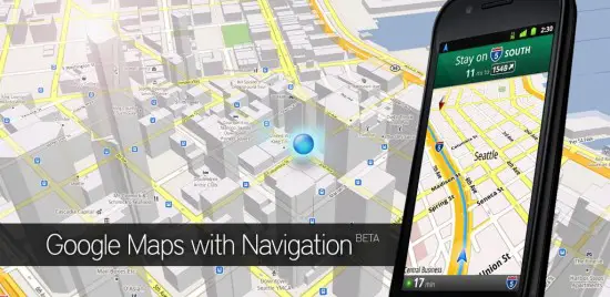
Google Map has just received a very interesting update. Firstly, elevation data has been added to the Measure lab. This will allow people to see if an area is hilly or uneven for whatever reason they may need to know. The scale and zoom bars have also been given some love as they move out of the “labs” department to find a new home under “settings.” Get the 7.26MB update in the Google Play Store.


I wish Google Maps would show you how fast you are going.
get waze. its a little better than google maps for navigation, as far as whats going on around you is concerned.
The elevation feature is good to check whether a tsunami would affect you, so this not a trivial addition for those in coastal areas.
However, the new Maps force-closes every time I try to use it (Lenovo ThinkPad Tablet, Tegra-2, android 3.1, Japan).
Elevation data is important for better calculating the estimated range of an Electric Vehicle.
It’s a pity Nissan didn’t use Google Maps in the LEAF… because I’m sure Google maps will be better in a couple of months widening the gap to any in car’s static navigation system.
In places like Colorado, elevation is very important. Now if offline 3/4 g so that it functioned better with just gps signal, this would complete the app!