
One of the cool features of Google Maps is the ability to enable 3D buildings. This means that you’ll be able to get a 3D representation of the buildings in the area, so in case the names and directions aren’t enough, the use of 3D models can make identifying places a little easier.
Now according to a report from 9to5Google, it looks like Google has started to roll out a test in which users will be able to navigate to their location while 3D buildings are enabled. Prior to this, 3D buildings weren’t available while navigating, but this recent change suggests that Google is allowing it.
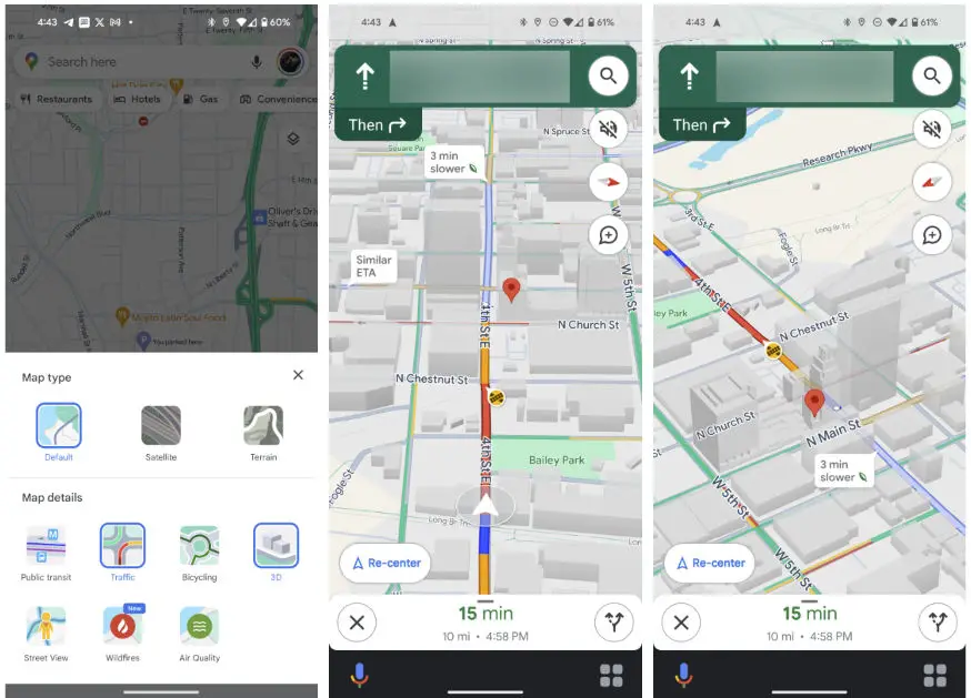
Image credit – 9to5Google
That being said, 9to5Google notes that 3D view needs to be enabled first before you can try it out, and also you’ll have to be zoomed into the map quite a bit. If you’re traveling through a densely populated area like a city, we suppose this is fine, but if you’re traveling long distance and want to get a better idea of the general direction, then maybe this could be less useful.
Overall we don’t think this will make or break the user experience, but it does add a nice change of pace and looks to the overall experience. Given that this is a test, not everyone will be able to access this feature yet and it’s hard to tell if Google will make it a permanent feature moving forwards.
Source: 9to5Google


Comments