
Google Maps is a great tool if you’re looking to navigate your way to somewhere you’re unfamiliar with, or figure out a train or a bus schedule, and so on. Now according to a post on Google’s blog, the company has updated its Maps app with a bunch of new features that will make it easier for you to plan your road trips.
One of those changes include toll prices, where Google Maps will be able to show you estimates of how much an upcoming toll will cost or if there are tolls along your route. This makes it easier for users who want to drive but also want to potentially avoid paying tolls along the way.
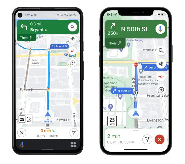
In addition to tolls, Google Maps will also now be able to show drivers traffic lights and stop signs, so if you’re trying to find the fastest route possible and avoid roads that could slow you down, these indicators could help. Google will also be adding more details to buildings and landmarks in Google Maps so that you have a better idea of where you are, especially if you’re in an area unfamiliar to you.
According to Google, these changes are expected to be rolling out in the coming weeks and will be available on Android, Android Auto, as well as iOS and CarPlay, so keep an eye out for those changes if they’re something you wouldn’t mind using.
Source: Google


Comments