Google Earth now incorporates geotagged Google+ photos


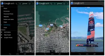
An updated version of Google Earth is combining your own pictures with the cache of satellite imagery showcasing the globe in extreme detail. After signing in with your Google account, a new option for Google+ photos (under the More Maps dialog) will pin geotagged images to their point of origin on the map.
When perusing Google Earth’s satellite view, any relevant images will appear as thumbnails which can be tapped to expand to a slideshow view. It’s a lot like Instagram’s Photo Maps, except the underlying world is far more detailed. It’s a contextualization of photos that adds a layer of rich depth. It would be great to see this sort of thing built directly into Google+, but for now having it as part of Google Earth will have to do. You can find the latest update in the Play Store now.
[via TheNextWeb]