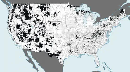
Mobility Fund visualizes the non-3G United States, too many areas lacking

For those of us from large metropolitan areas, we often take our 3G, if not 4G, coverage for granted, but the number of areas in the United States not serviced by a high-speed mobile network may surprise you. Each splotch of black on the above map represents an area of the US population that was not receiving at least 3G coverage as of January 2012. The splotches become bigger and bigger as you move out west.
The interactive map (embedded below) allows you to zoom in and get a better idea of just how many citizens are affected. The numbers are usually rather low, ranging from a handful of people up to a few thousand, but they add up. Most of these areas are less densely populated with wide gaps in infrastructure, but some can be found just miles from the biggest cities in the country, including New York.
The bigger issue is that mobile providers continue to upgrade their networks in the big markets while ignoring the needs of those stuck with 2G coverage, a problem the Mobility Fund is hoping to call attention to through their startling look at US mobile coverage. While we sure do love our 4G connection speeds, other shouldn’t have to miss out based on where they live.
[via WinSource | Thanks, Samantha!]