Google Maps Gains Live Transit Updates

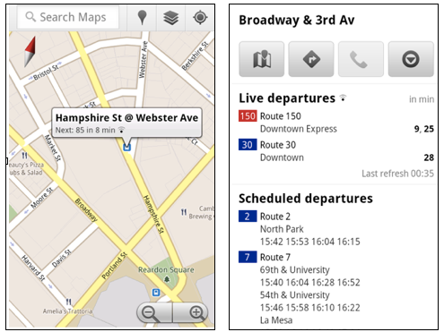
Google Maps has done it again with an update that further aims to ease the pain of your daily commute. The latest version of Maps for Android now features live transit updates to keep you abreast of any delays that might be holding up your public transportation. The update won’t change the way you use Maps all though much, though. Simply click on a public transit station icon on the map and you will find “live departure times” letting you know exactly how long you will need to wait. Service alerts let you know of any imminent changes.
For now, live transit updates are only available for those taking public transportation in Boston, San Diego, San Francisco, and Portland in the US, and Madrid and Turin in Europe. Google says they are working closely with other partners to bring the feature to more cities.
[via Google]