

Google announced via the LatLong Blog today that they’ve refreshed Maps and Earth with over 800,000MP of all new, crystal clear satellite imagery.
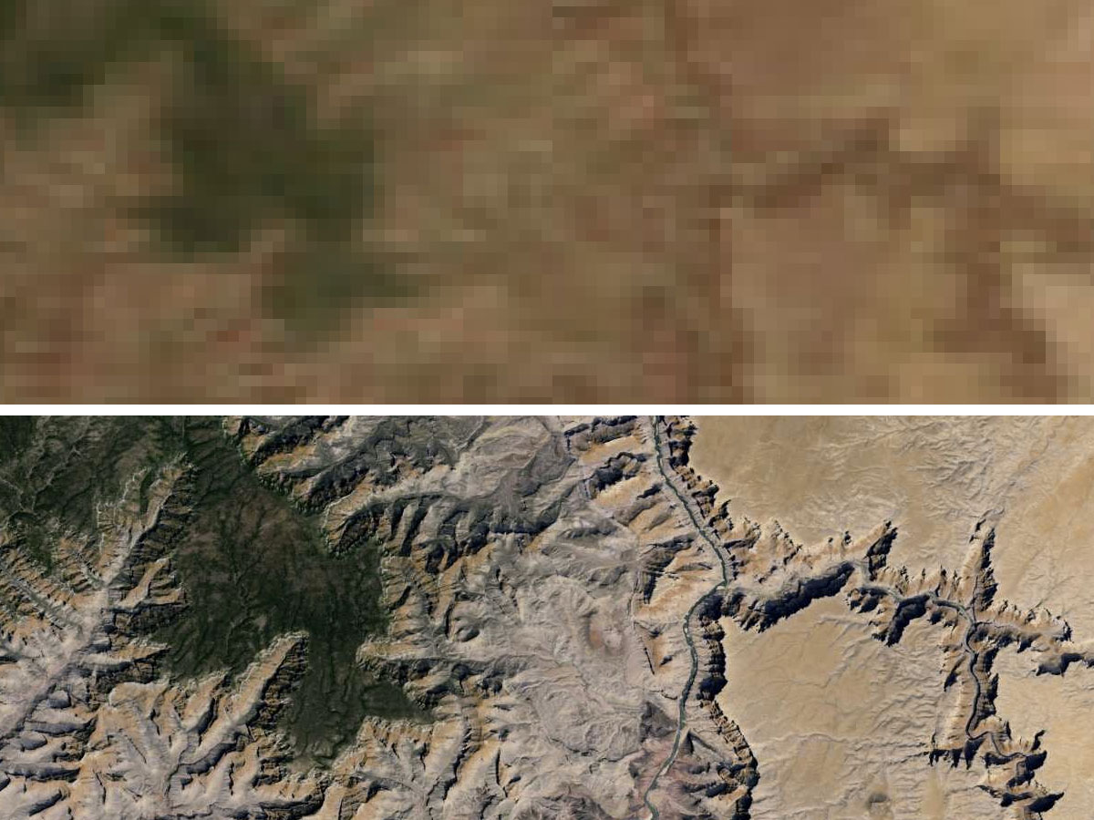
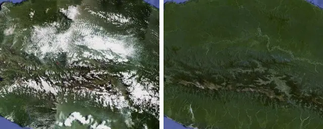
Using their very own Google Earth Engine and images taken from NASA’s Landsat 7 satellite, you can now view Earth as she was meant to be seen, without the pesky atmosphere getting in the way. Besides clearer, higher-resolution images, Google was able to effectively remove clouds and other atmospheric effects from the earth, allowing Maps and Google Earth users to view the planet completely uninterrupted. The results are pretty dramatic (see below).
As for the future, Maps and Earth will only continue to improve. Google is currently waiting to get their hands on images taken from the upgraded Landsat 8 satellite that was launched earlier this year. Exploring planet Earth has never been more fun.


Can they make it rain too?
With Google almost everything is possible!!!! Lol ;p
Except the Patriots having a decent TE this season.
hahahahah!
Another reason why I said ALMOST ;-/
If they make it rain money on my house, I’d be happy.
Can they really claim to be accurate if they show Seattle without clouds?
To be honest, you wouldn’t even see Seattle without them removing the clouds.
Fair point. But would that be so wrong?
I spent a week in Seattle during summer and all but one day was clear skies.
In other news, Apple just added a new icon to Apple Maps in iOS 7.
With your choice of pink, baby blue or lime green
It’s iOS, you have no choice
it would be nice if Clouds would be available as a Layer option. Sometimes it’s nice to see all of mother natures effects.
Didnt google launch their own hi res satelite a while back, so why use NASA’s Landsat 7 satellite? And I still see cloudy low res images, look up Cayman Islands for example.
Can anyone tell me what the hell is being covered here? Eastern part of Alaska.